IRIDE Satellite Constellation Enters Operational Phase: A New Era for Earth Observation in Italy
The Italian Space Agency has announced the operational phase of the IRIDE satellite constellation, a significant step in Italy's Earth observation program, providing valuable data for environmental monitoring and resource management.
The Italian Space Agency (ASI) has officially announced that the IRIDE satellite constellation has entered its operational phase, marking a significant advancement in what is now the country's most crucial initiative for Earth observation from space. This milestone is not merely a technical update; it represents a transition from the construction of the project to its real-world application, with the first data and services now available for ground users.
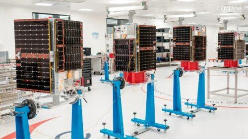
IRIDE is driven by a clear objective: to utilize space technology to enhance terrestrial observation and provide useful information for environmental monitoring, land change tracking, resource management, and emergency response. This goal underscores that IRIDE is more than just a collection of satellites; it is designed as a comprehensive national infrastructure for Earth observation, capable of transforming satellite data into operational geospatial services that support public decision-making and coordinated planetary monitoring. This initiative aligns with broader Italian investments facilitated by the National Recovery and Resilience Plan, complemented by the National Complementary Plan, and has been developed in coordination with the European Space Agency and the Italian Space Agency. The project, first introduced in May 2022, is set to be realized over five years, enhancing Italy's capacity for low Earth orbit observation. The announcement of the operational phase, formalized on July 1, 2026, signifies the tangible results of this long-term planning effort.
To fully appreciate the significance of IRIDE, one must consider its architecture. The program is designed as an end-to-end system, encompassing a complete supply chain that begins with satellites and extends beyond mere observations from space. This comprehensive approach highlights that the program's strength lies not only in the number of satellites or the quality of sensors but also in the ability to connect data acquisition with processing and operational use. The orbital component of the system will ultimately consist of 68 satellites organized into six constellations, equipped with radar and optical sensors characterized by various spatial, temporal, and spectral resolutions. This diverse structure allows the program to conduct multiple types of observations, combining different tools to yield complementary information: optical sensors can capture various aspects of the Earth's surface, while radar sensors are invaluable for observing the terrain under adverse weather conditions or in the absence of sunlight.
One of the most intriguing aspects of IRIDE is its organization into six constellations rather than a single series of identical satellites. This design choice aims to create a more flexible network suitable for various applications. The complementary nature of the missions enables the observation of the national territory under different lighting and weather conditions, providing a richer, more continuous data set that is essential for generating geospatial services. Thus, the orbital segment serves as merely the first layer of a broader system, intended not just to observe Earth but to produce actionable information.
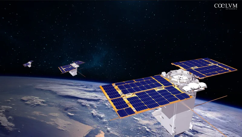
In addition to the satellite network, IRIDE includes an equally vital downstream segment consisting of all the structures that receive, organize, and process the data transmitted by the constellations. This segment is responsible for acquisition planning, satellite operational control, data reception and processing, archiving, distribution, the IRIDE Marketplace, and the entire Service Segment. Without this infrastructure, the observations collected in orbit would remain mere data; however, with it, they can be transformed into geospatial products, analyses, and operational services for institutional users.
The practical implications of the program become clearer in this context. IRIDE is primarily designed for Italian public administrations, enabling them to integrate services into their decision-making processes and routine land management activities. The system's services are organized into eight application domains, ranging from marine and coastal monitoring to air quality, land movement, land use and coverage, hydrometeorology, climate, water resource management, emergencies, and security. Beyond formal classification, the concrete impact of IRIDE is paramount: it facilitates coastal erosion control, monitors ground and infrastructure deformation, supports the forecasting and management of extreme events, analyzes water availability, and provides rapid assistance for civil protection activities in the event of floods, fires, or other natural disasters. The core of the project is to link spatial data with the daily needs of the country. Rather than merely observing the planet, IRIDE aims to deliver information that can be integrated with numerical models, databases, and other institutional information sources, thereby generating operational knowledge rather than simple observation. This modern approach positions the project as a platform capable of transforming data into a tool for work and support for the community.
While the transition to the operational phase does not imply that the program is fully complete, it is essential to view this milestone in the right perspective. The activation will proceed progressively, following the completion of the constellations, ground infrastructures, and planned services. Nonetheless, ASI's announcement marks a definitive threshold, indicating that IRIDE has moved beyond purely construction phases into practical application. Thus, Italy is not just launching a new satellite project; it is establishing a structured capability for observing and interpreting its territory, poised to play an increasingly vital role in environmental protection, risk management, and the development of new services based on data from space.